ZENIT Tracks
Explore the world safely with ZENIT Tracks, the ultimate 3D and Offline maps app with GPS recording. For Android and iOS.
Explore the outdoors like never before
Whether you're a daring backcountry skier, an avid trail runner, an interpid hiker, or a fearless mountain biker, ZENIT Tracks is your essential guide to the great outdoors. Immerse yourself in the most realistic 3D maps designed to make your adventures safer, more accessible, and undeniably enjoyable
Available for Android and iOS
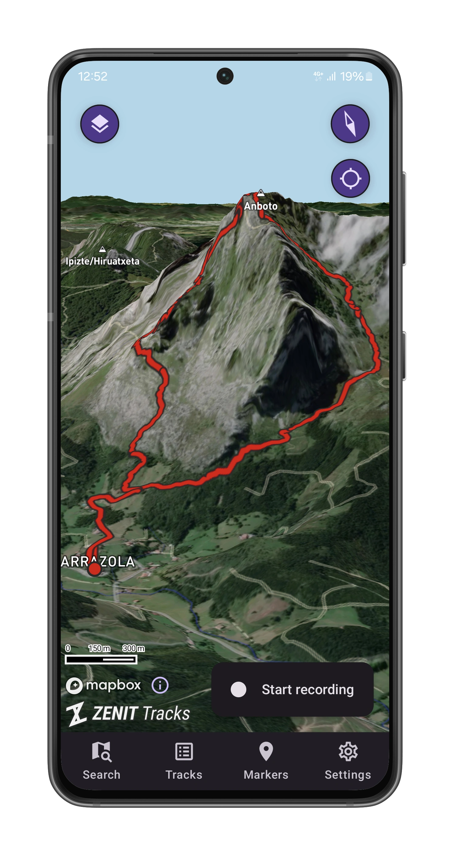
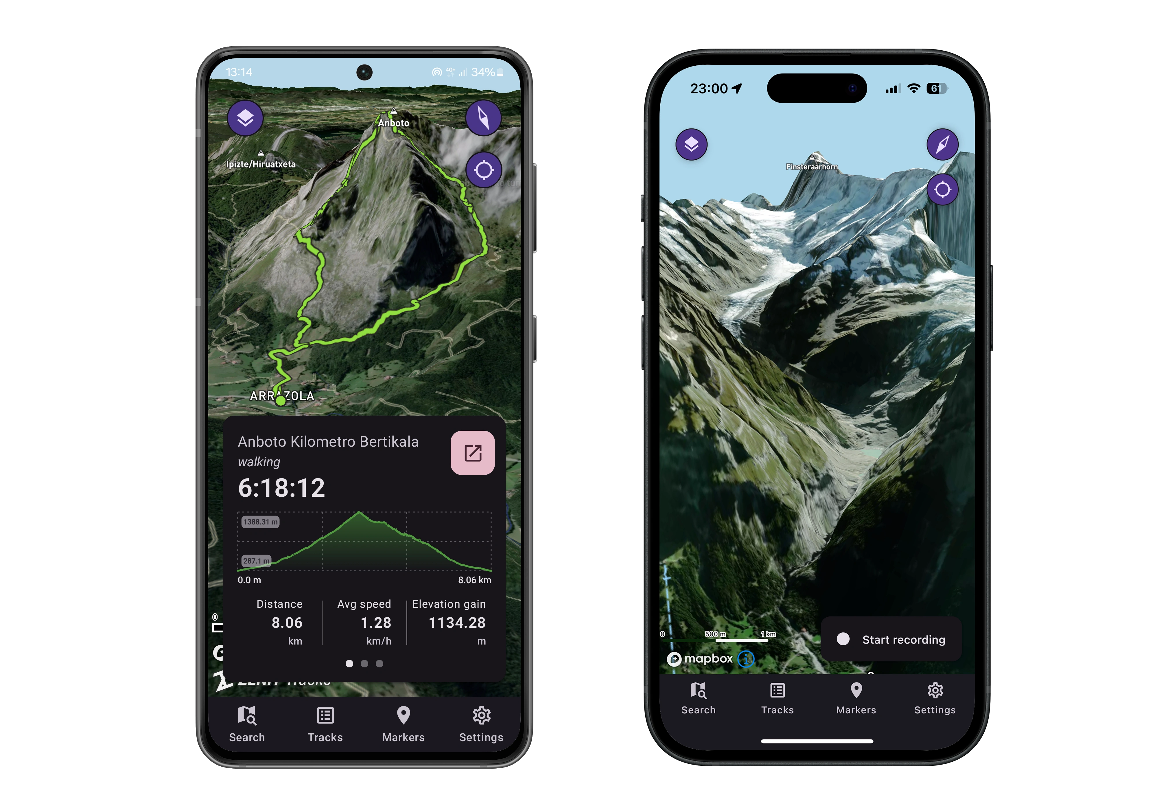
Discover the Power of Route Tracking
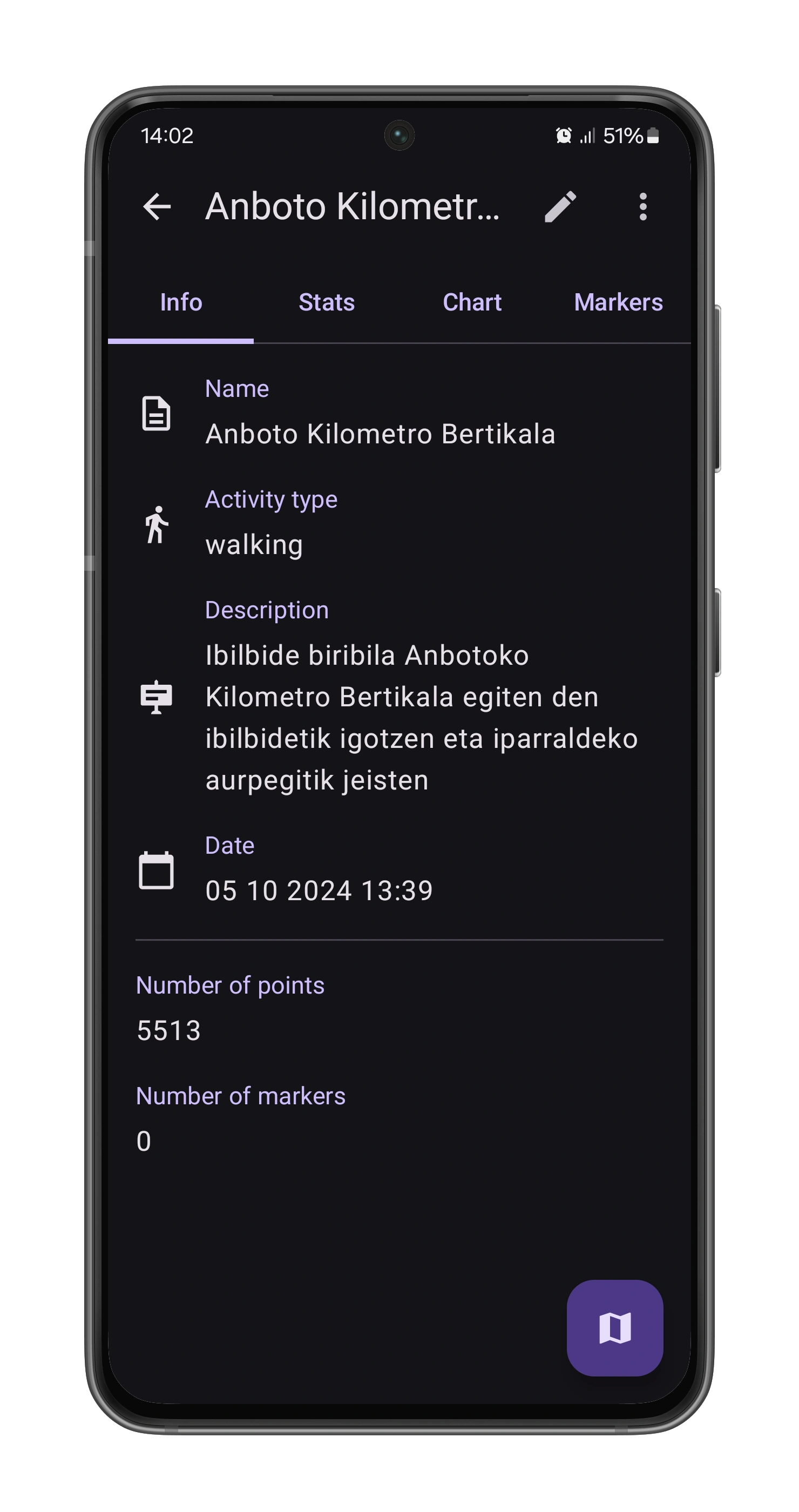
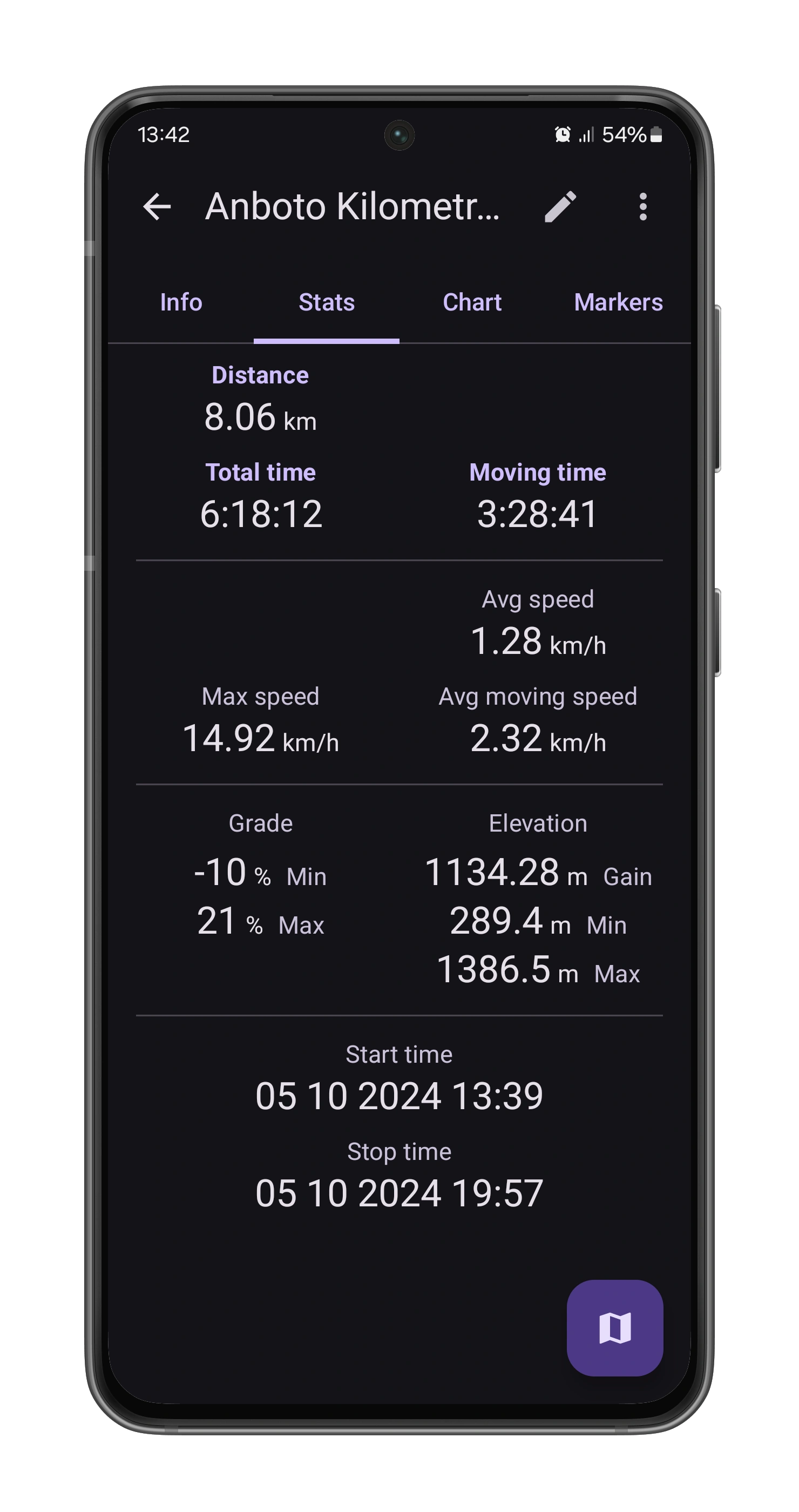
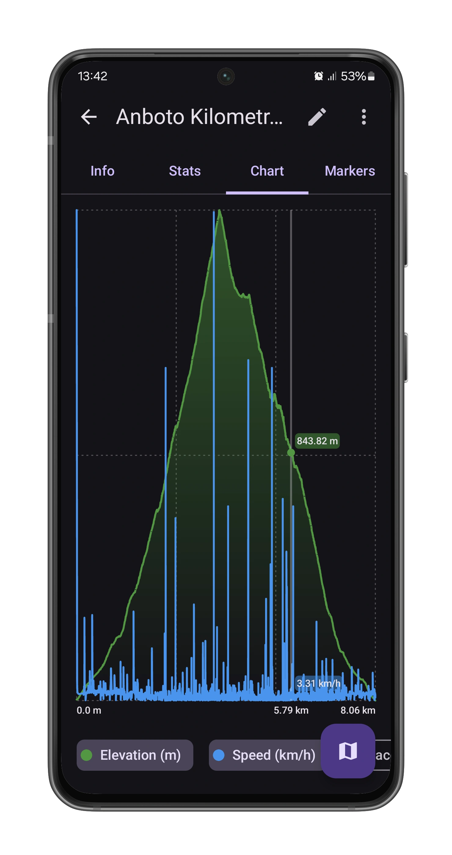
Transform your outdoor adventures with ZENIT Tracks, the ultimate tool for route tracking. Leveraging GPS technology, ZENIT Tracks plots your routes on highly-customizable maps, capturing every detail. Track your distance, speed, route gradient, and more. All your stats are beautifully presented, either as comprehensive data or in stunning charts.
3D Realistic and Offline Maps
Route Tracking with GPS Recorder
Import and Export your tracks
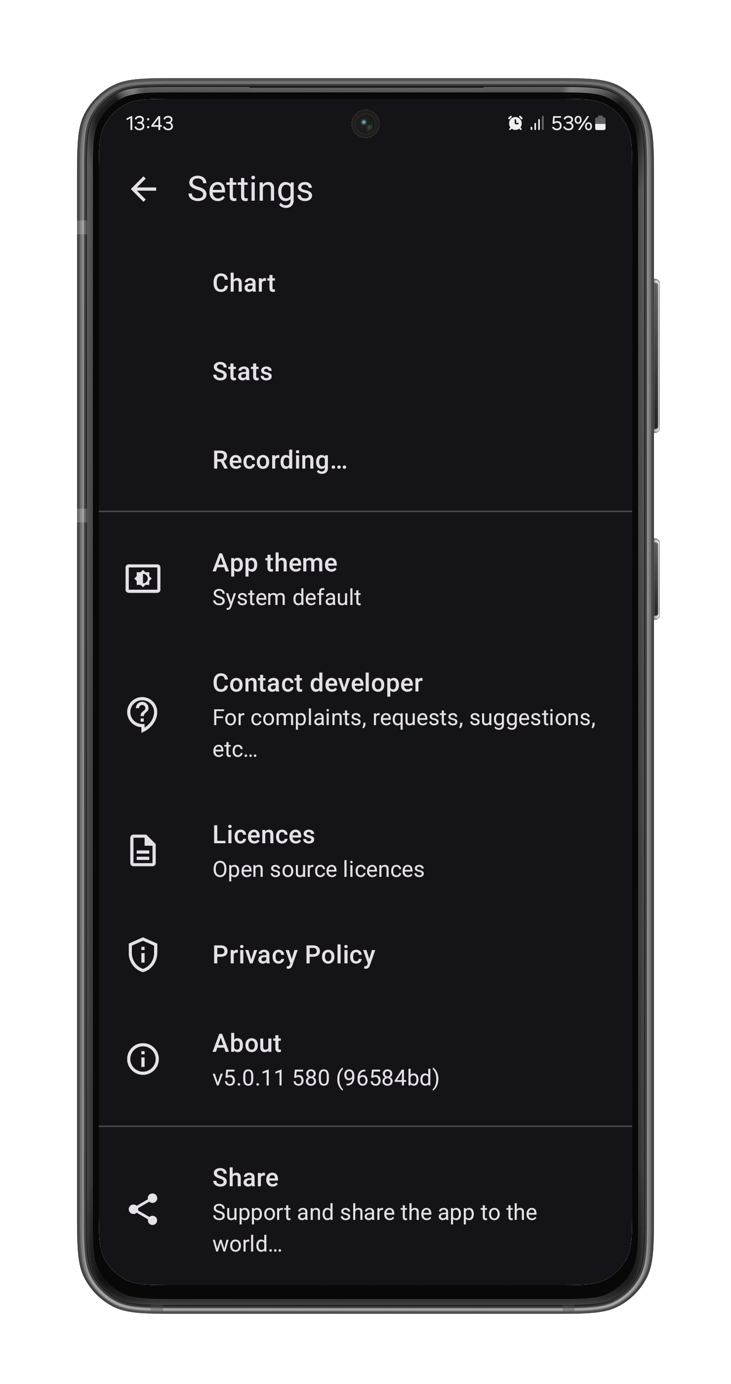
Minimal and clean UI